|
|
|
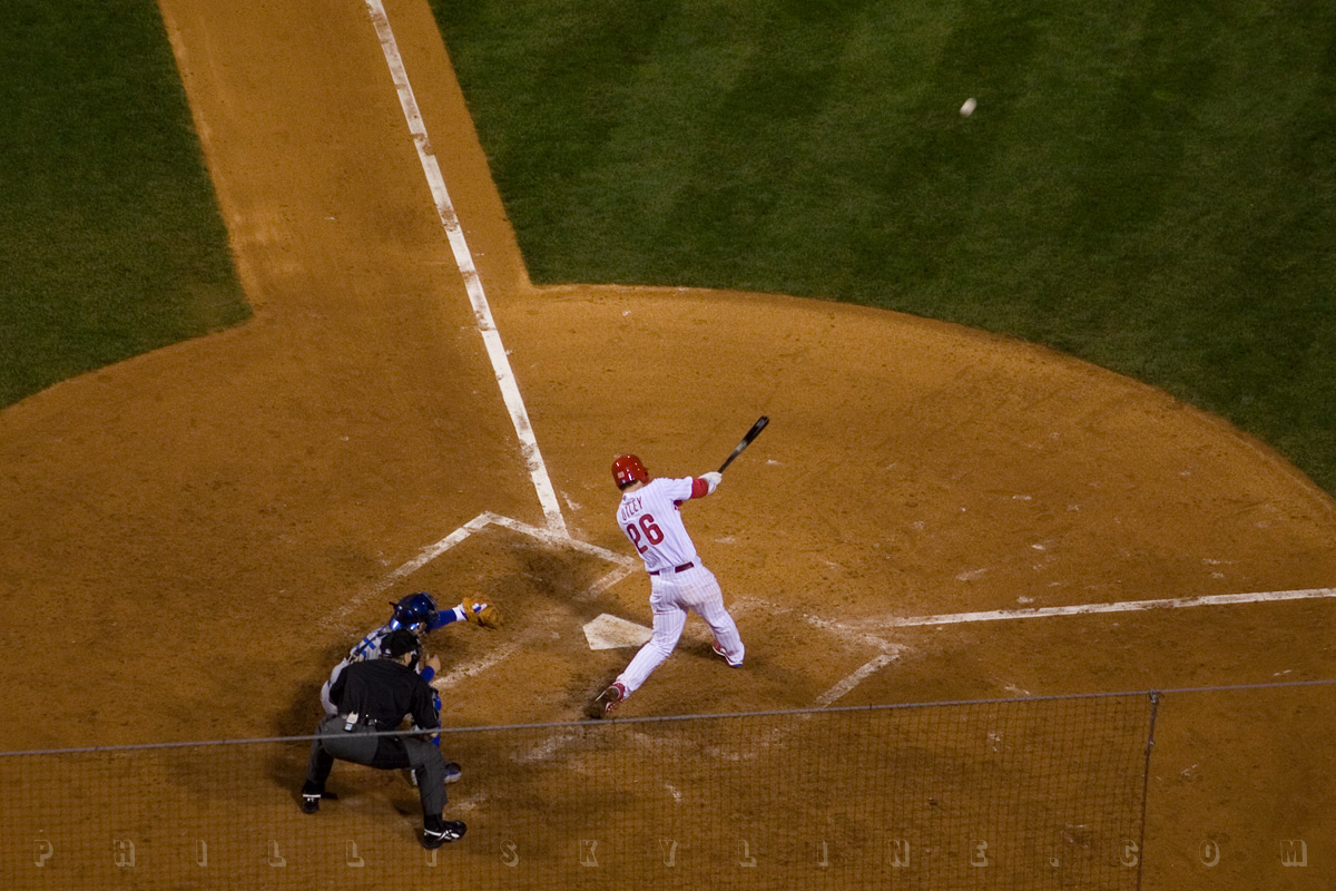
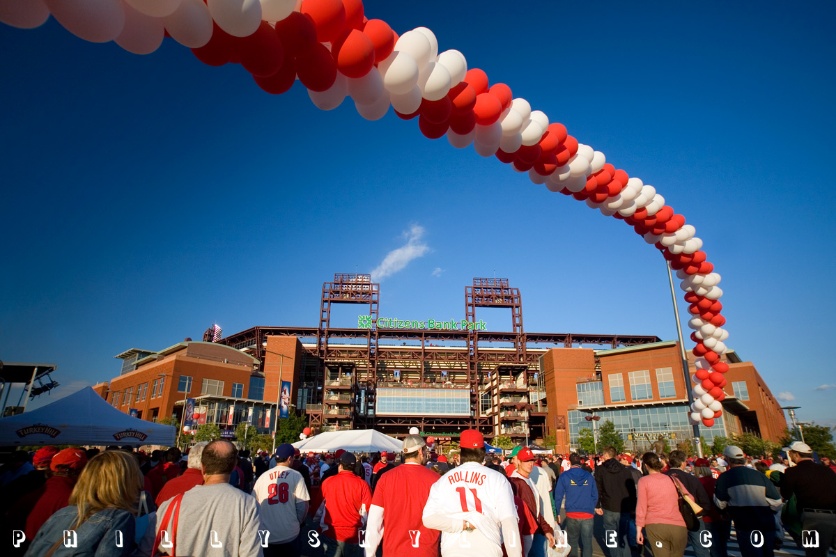
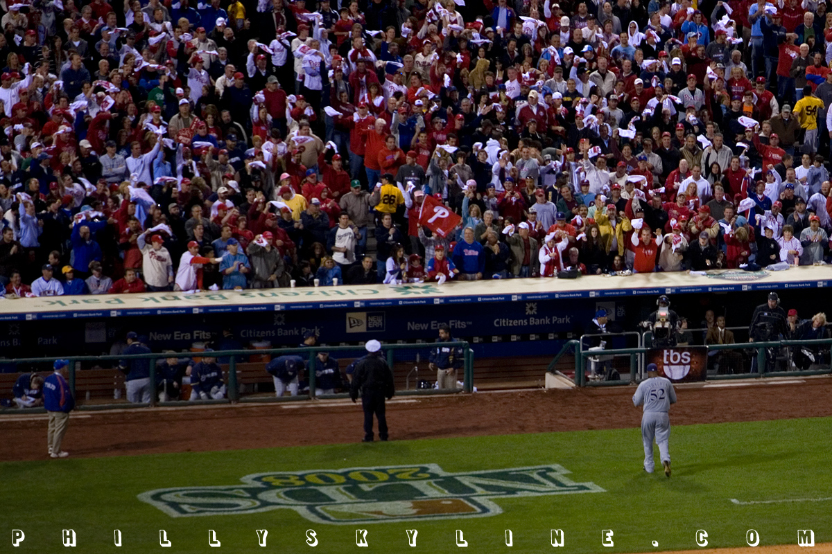
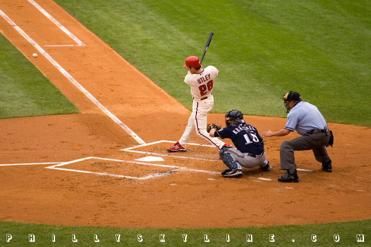
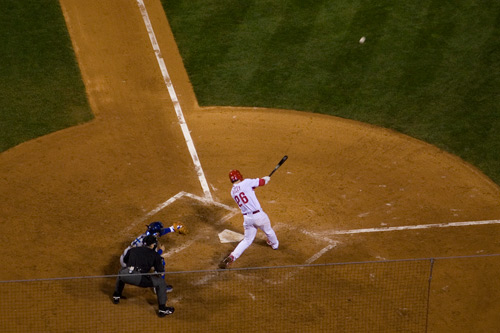
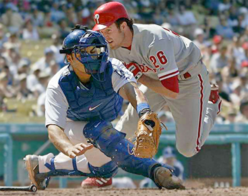
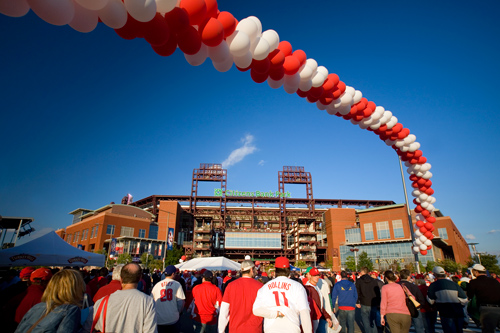
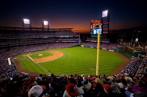
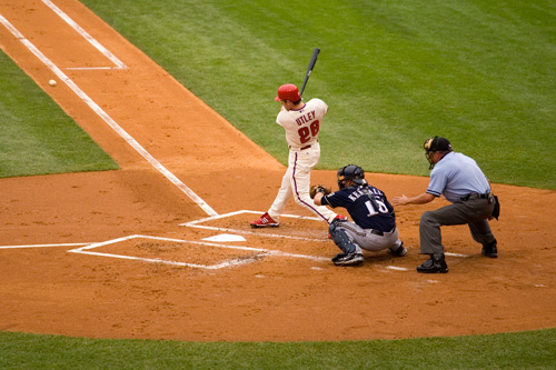
10 October 08: BURRELL BOMB
Good to see the Phillies scoreboard graphics department saved that one from last year. Even better to see they needed it. Pat Burrell and Chase Utley have officially awoken from
their postseason slumber, and thank heaven for that. What a night at the ol' ballpark!
The fans have been nothing short of incredible during this playoff run. We ran CC Sabathia out of his game, and we got into Derek Lowe's head long enough for him
to have a mini-meltdown, two homerun, three run inning that was the only difference the Phils needed. Enter Brad Lidge, game over. Insane. All is well inside
Citizens Bank Park.
Also, I have to give a shout to the little dude, maybe 10, in the row in front of us at the ballpark. He sat quietly through the first five innings, but when the Phillies came
up to bat in the sixth, he put his rally hard hat with a red police light on, and whattaya know, Chase and Pat went deep. Nice work, kid.
To launch a mini-essay of NLCS Game 1 (18 photos total, about 4.5M in size), click
HERE.
–B Love
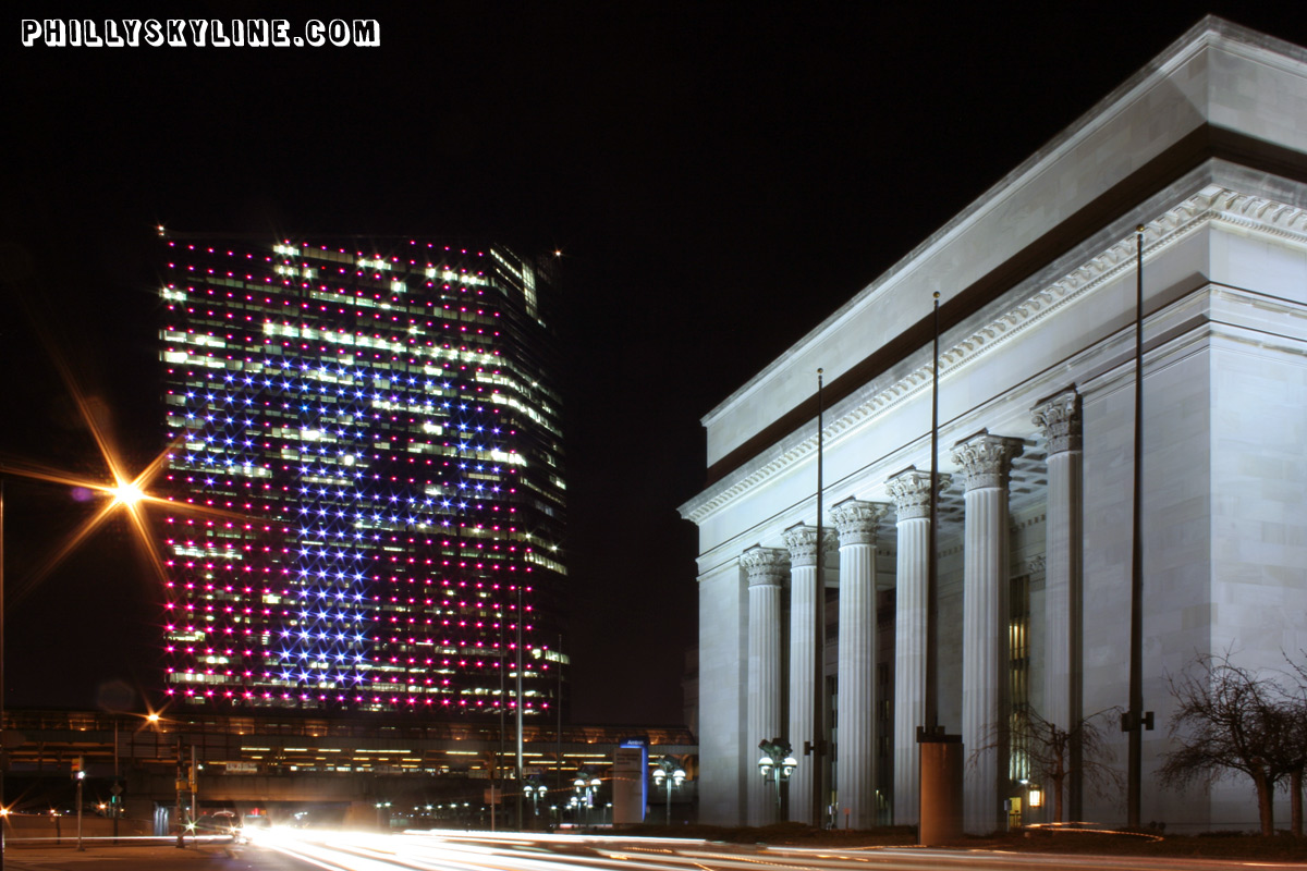
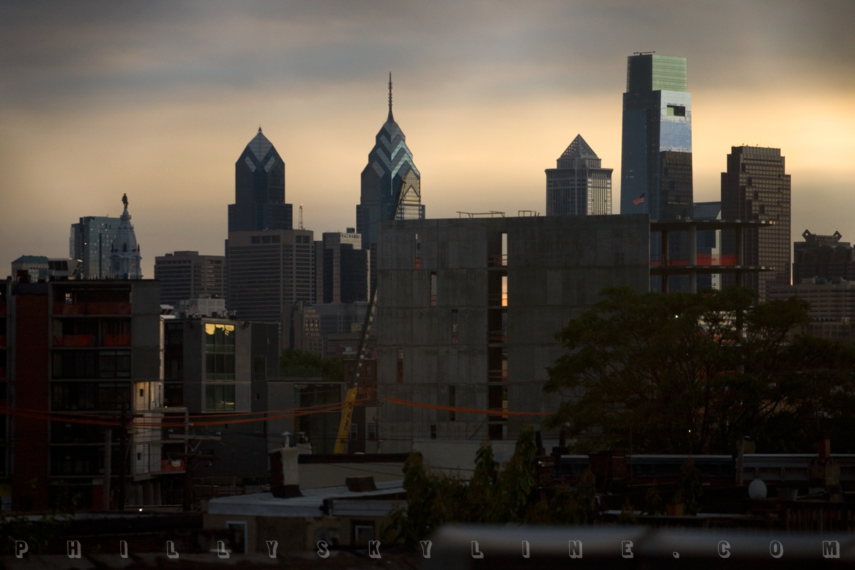
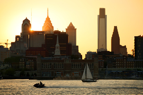
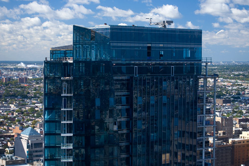
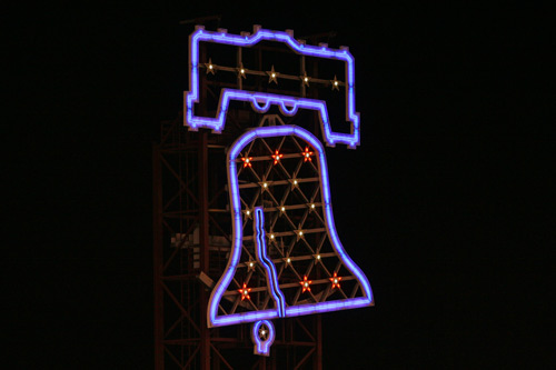
PS: I'm with The Illadelph here . . . Building owners in Center
City ought to have the same Phillies Fever the rest of the city has, no disrespect to Breast Cancer Awareness Month and all. Last night from my high up perch (would it kill the
Phillies to give partial season ticket holders their same seats for at least ONE playoff game?), I
noticed only Cira Centre lit up for the Phillies, in its all-red-with-white-P. Well done, Cira Centre. But the rest of you . . . come on now. We'll give you a mulligan
for this Game 1 gaffe. Game 2 is a day game today . . . but uh, a little later this month, might wanna keep the red handy, fellas. Especially One and Two Liberty with your
fancy pants LEDs.
Cira Centre from the archives:
|
9 October 08: Brace yourself . . .
Here comes the NLCS.
Best not to pay any mind to any sabre rattling, no-name columnist from the LA Times. He did the same thing -- the exact same tired lines, if I recall correctly --
when the Lakers met the Sixers in the Finals in 2001. When USC played Nebraska, he called people from Nebraska corn-fed porkers. Why even waste your time with
provocation for provocation's sake? Let's just send him home to hang with his baseball fans that show up late, leave early and eat fish tacos. That's if he
even comes to Angry-ville.
Whatever, TJ. We're about to take the train to Happy Town. WOO! WOO!
LET'S GO PHILS!
–B Love
(LA Times photo from Blue Notes blog, May
2006.)
|
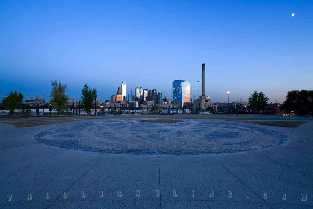
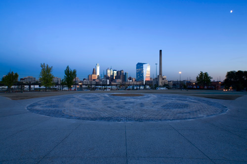
9 October 08: Presenting . . . POWELTON GREEN
DREXEL COMMUNITY PARK
Ladies and gentlemen, boys and girls, meet your newest neighborhood park. Some long planned riverfront park? Nope. A rails-to-trails program in a rust-belt-y,
post-industrial part of town? No sir. A collaboration between a big university with big money and a neighborhood that will use it? That's the one.
The above is a wide angle, half moon photo made just past sundown at the park which is not yet officially called Powelton Green, and for that matter, which is not
yet officially open. And, I've just learned, Powelton Green, its working name,
will be foregone for the newly minted Drexel Community Park. It's an instant boost of beauty to the campus Radar Magazine famously anointed ugliest campus in the country back in
August.
As I was taking the photo, a Drexel bike cop came by to make sure I didn't 'ruin anything' (I do have a tendency to ruin dirt, I suppose), and another came by and
said I really can't walk there. She was actually very nice, and like myself, didn't understand that if they didn't want anyone to be on the new park yet, why they
took the fence down so soon.
Nevertheless, there it is, Drexel Community Park. If you're a longtime reader of Philly Skyline, it may be a familiar view to you . . .
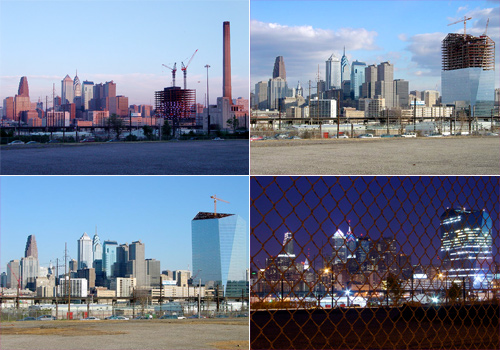
These four photos were taken over the course of Cira Centre's construction which, hooboy, was a whole presidential election cycle ago. (In searching for those
photos, I came across some from John Kerry rallies. Sigh.) Click that collage to go to travel four years back through time for our Cira Centre construction section.
And when you're done, set the come-back portal eight days ahead to next Friday, October 17. That's the day Drexel University is holding its convocation to officially
open its new Community Park.
The long-vacant and fenced-in lot, between Powelton Ave and Baring Street, 31st and 32 Streets, formerly the site of the Consolidated Laundry building (it's the
Pennsylvania Laundry Company in this photo at
PhillyHistory.org), has been rebuilt as a new park over the past year. It was built by labor donated from Drexel trustee Robert Buckley, Sr. "His generosity really
made it possible for us to buy nice lanterns and benches," says Jim Katsaounis, executive director of Drexel Student Life and Administrative Services. "We're excited
about being able to take a fenced in gravel lot and turn it into open green space."
Purchased in 1997, (The Triangle, July 2005), Drexel originally had the intention of building new housing on the site, the park was ultimately a compromise. "I'd
call it a collaboration," Powelton Village Civic Association president Michael Zuckerman says. "Maybe a one sided collaboration," he jokes, "since they're paying for it."
Zuckerman is also quick to credit Councilwoman Jannie Blackwell for stepping in to broker a deal between the University, who wanted a six story apartment building,
and the Civic, who wanted a park. Per the agreement, Drexel can only use the southern half of the site for construction, and only after a five year period. The
northern half will remain a park in perpetuity, a key axis between the university and the well used Spring Garden Bridge.
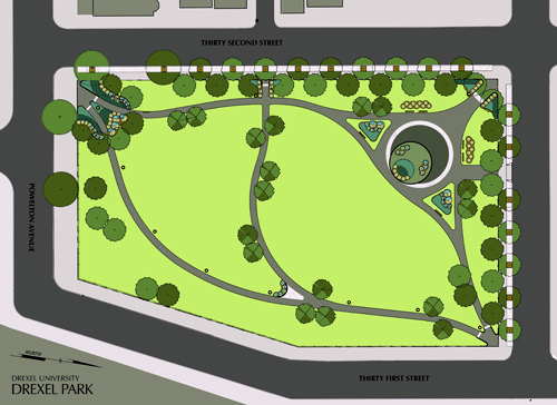
The new park, at a size of 2.5 acres and a cost of $500,000, is still coming together in anticipation of the event on the 17th. The lanterns and benches are still
being installed, but the sidewalks within the space are paved, grass has been planted, stone pavers have been placed on the outer rim of the park (the sidewalks on
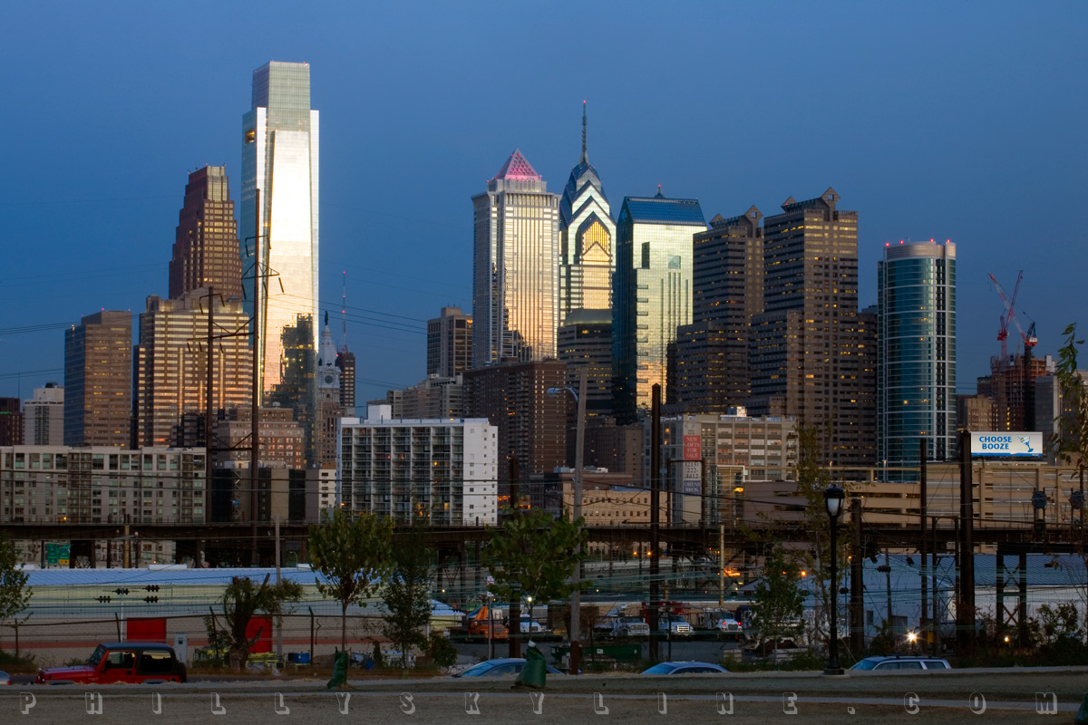
the border streets), and perhaps most importantly, the streetscape along 31st Street has been vastly improved: the old broken sidewalk has been repaved, and the
excess shrubbery and weeds on the fence to the Septa railroad yard have been removed, making for breathtaking views of the skyline, particularly at sundown.

To date, 35 of 45 trees have been planted at the park, but the most important one will be planted next week: the American Liberty Elm. With the ceremonial planting
will be the dedication of a plaque reading:
This American Liberty Elm was named after "The Liberty Tree: Our Country's first Symbol of Freedom." On the morning of August 14, 1765, the people of
Boston awakened to discover two effigies suspended from an elm tree in protest of the hated Stamp Act. From that day forward, that elm became known as "The Liberty
Tree." It stood in silent witness to countless meetings, speeches and celebrations, and became the rallying place for the Sons of Liberty. In August of 1775, as a
last act of violence prior to their evacuation of Boston, British soldiers cut it down because it bore the name "Liberty."
Drexel Community Park officially opens next Friday, the 17th. A barbecue with the university and neighborhood begins at 4, and the official dedication and tree
planting with Councilwoman Blackwell and Drexel President Constantine Papadakis begin at 5:30.
UPDATE: Now with rendering goodness, courtesy of Drexel University Planning, Design & Construction:
–B Love
|
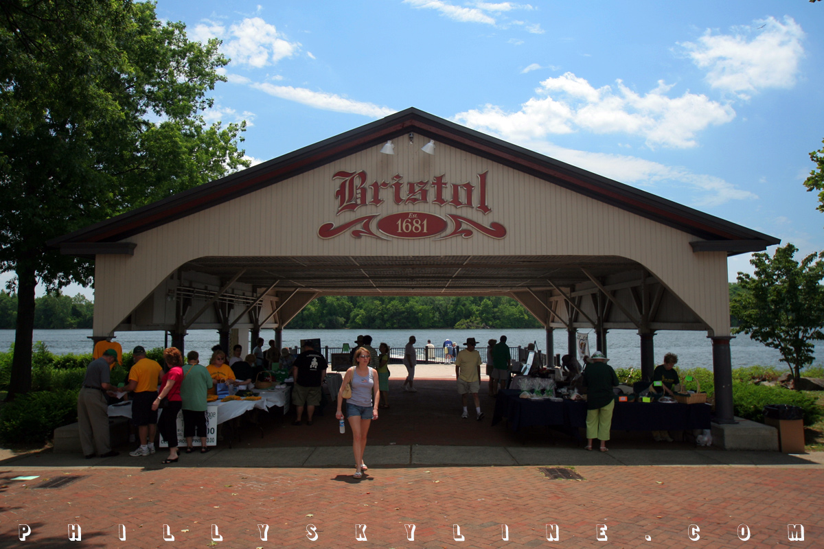
8 October 08: The Bristol stomp

Here's a quickie leftover from the Summer of the Delaware photo show: Bristol's riverfront.
Bristol Borough, the oldest in Bucks County (settled by the English in 1681 and incorporated in 1692) is eight miles northeast of northeasternmost Northeast Philly,
and about 23 from Center City.
I don't personally know a whole whole lot about the place, but I've heard the public school is unstable and that crime is high, at least relative to other suburbs.
If that's true, neither of those things was apparent from a brief afternoon visit I had over the summer. In fact, the riverfront park was brimming with people and
Irish folk music for the annual Bristol Celtic Day. The gelato place on Radcliffe Street even served 'Irish potato' gelato, and surprisingly, it was
delicious.
 Lions Park affords lots of shade and fine views of the Delaware River, looking directly across the river at Burlington Island, and there are lots of sailboats from
nearby marinas. Radcliffe Street also has a lot of huge, private mansions with their own riverfront access. Unfortunately, there are several enormous surface parking
lots right on the river too.
Lions Park affords lots of shade and fine views of the Delaware River, looking directly across the river at Burlington Island, and there are lots of sailboats from
nearby marinas. Radcliffe Street also has a lot of huge, private mansions with their own riverfront access. Unfortunately, there are several enormous surface parking
lots right on the river too.
The park is also home to three widely different sculptures: a bust of Christopher Columbus (dedicated for the 500 Celebration in
1992), a monument to the Spanish guardhouses of San Juan "dedicated to the Puerto Rican people who have made their homes in Bristol" (date uncertain), and a statue
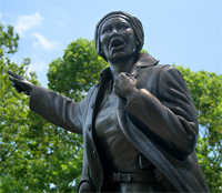
of Harriet Tubman, "Authentic American Hero" dedicated in 2006. According to the Harriet Tubman Journal, it's one of only three statues of her in the country, the others being in Boston and Ohio. There is also a gold lion
(it's Lions Park, after all) and a six foot green glass flame at the main plaza of the promenade.
All in all, Bristol seems like a nice little town. Its history predates William Penn and includes a number of interesting other chapters including industrialization
(the Delaware Division of the Pennsylvania Canal, which goes all the way to Easton, ended here) and suburbanization (the development of Levittown encroached on
farmland in Bristol Township). For more on its history, visit the Bristol Cultural and Historical Foundation's web site HERE.
To launch a mini-essay of Bristol's riverfront (15 photos total, about 2.6M in size), click
HERE.
–B Love
|
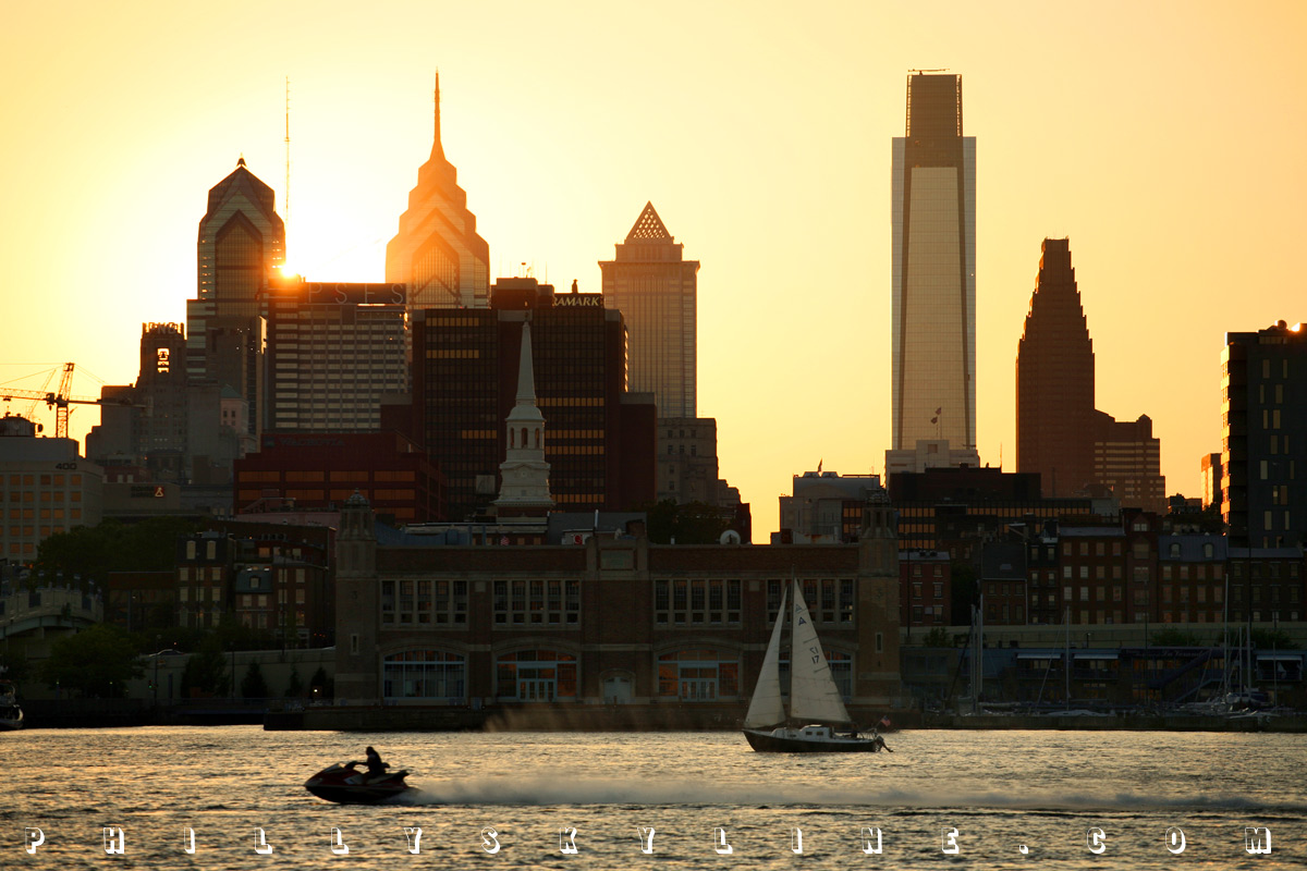
8 October 08: By the way, which one's pink?
Or, the Philly Skyline PINK PHOTO CHALLENGE

Or rather, which ones are pink? October, as usual, means breast cancer awareness month and pink ribbons and pink Brian Dawkins jerseys and pink buildings. The list
of participants is longer this year than ever before -- over 40 in Philadelphia, and several more in South Jersey and Wilmington. Good on ya, all of you.
Here's a Philly Skyline photo challenge: if you can get good photos of twenty-four (24) different buildings, you've got yourself a case of the Philadelphia Brewing
Company beer of your choice. Good is the operative word here. This isn't a gimme -- since the buildings/fountains/bridges/battleships are only lit up at
night, chances are you're going to need a tripod and some patience. But if you have those, there's a case of cold, local booze in it for you. If you don't drink,
just give it to your dad. Plus, since they're good photos, we'll put em up right here on ye Skyline, credited to you and with a link to your
blog/site/Flickr/Myspace/etc. The 24 can come from any combination you like -- a single exhaustive night with your tripod in Center City, a week of travel to AC and
Camden and Wilmington and Villanova, whatever you like.
Check out the list of participants at CBS3 HERE.
To kick off the contest, the Philly Skyline Philly Skyline above was taken last night at the Mann Music Center. I took at least eight photos (each 20-30 second
exposures) and every single one of them had streaking lights from planes or helicopters. At one point I counted nine aircraft in the sky.
–B Love
|
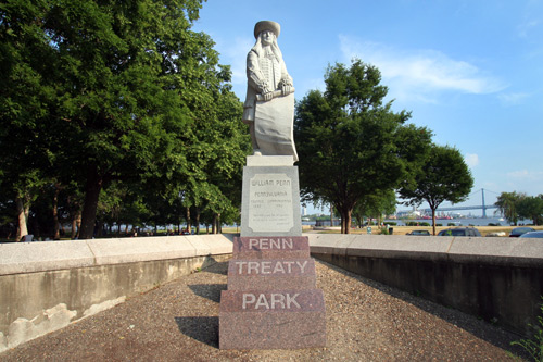
7 October 08: Our sacred ground
If Philadelphia is our religion, then Penn Treaty Park is our Holy Land. Having lived on South Street, within a couple blocks of the Schuylkill River and its park,
Doobies and the Sidecar, for four years (and on Fitzwater for two before that), leaving G-Ho and its walking distance to Center City's everything
was a difficult decision. Knowing the Delaware had no trail like the Schuylkill's (it's coming, slowly but surely, bit by bit), making the investment
and move to Fishtown was a tough decision . . . a tough decision that was a lot easier after a couple bloody marys at Johnny Brenda's and a session on the rocks at
Penn Treaty Park.
 Penn Treaty Park has gotten a lot of attention over the last few years, and for most of the right reasons. Sugar House is moving a lot of dirt just a couple parcels
downstream; the prospect of its traffic on Delaware Avenue and the impending rebuilding of the Girard Avenue interchange of I-95 have created concern for the Park's
many regulars. PECO's partial demolition continues right now, right next door on the upper portion of its Delaware Station, the beautiful, massive relic of
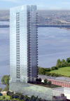
power designed by John T Windrim that needs to stay there. Next door on the other side, a 30 story condo tower is proposed for a circa-2005 market. From the
Penn Treaty Tower web site, which has lots of smiling white people and which makes no bones about wanting
to flip the property, going as far as mentioning "C3 zoning for a high-rise real estate opportunity":
Penn Treaty Park has gotten a lot of attention over the last few years, and for most of the right reasons. Sugar House is moving a lot of dirt just a couple parcels
downstream; the prospect of its traffic on Delaware Avenue and the impending rebuilding of the Girard Avenue interchange of I-95 have created concern for the Park's
many regulars. PECO's partial demolition continues right now, right next door on the upper portion of its Delaware Station, the beautiful, massive relic of
power designed by John T Windrim that needs to stay there. Next door on the other side, a 30 story condo tower is proposed for a circa-2005 market. From the
Penn Treaty Tower web site, which has lots of smiling white people and which makes no bones about wanting
to flip the property, going as far as mentioning "C3 zoning for a high-rise real estate opportunity":
Designed for success in tourism and retail, Penn Treaty Tower is also a prime residential opportunity for suburban couples and families who want to
remain off the city street grid but close to all the benefits of urban life.
Fortunately for our city so entrenched in its own history, Penn Treaty Park predates luxury towers that won't happen and slots barns that are the opposite of luxury
and interstate highways being built and rebuilt. In fact, our worship of Penn Treaty Park predates Penn Treaty Park itself.
Looking backwards through history, we pass the city's tercentennial celebration in 1983, the general acceptance of Lower Kensington's renaming of Fishtown, the
park's official dedication in 1893, the placing of the granite obelisk -- the first public monument in Philadelphia -- in 1827, and the great lightning strike of
1810. That lightning strike destroyed the elm tree which was the alleged site of the treaty of friendship between Penn and his Quakers and Tamanend and his Lenni
Lenapes.
 That 280 year old elm tree was, one could say, martyrized by that lightning strike. Descendants of the tree exist from seeds planted at Pennsylvania Hospital, in
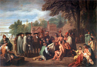
Haverford, and indeed at Penn Treaty Park. The legendary tree and the legendary treaty are depicted in Benjamin Rush's painting Penn's Treaty With the
Indians. The oil on canvas, measuring 75½" x 107¾", was commissioned by Thomas Penn, son of the founder, in 1771. On the eve of the American
Revolution, it's ironic that West, himself a Quaker, was stationed in London, where he'd moved in 1763, never to return to his native Pennsylvania. In fact, the
American was appointed official history painter to Britain's King George III. (Michael Lewis, Mark Hain: Pennsylvania Academy of the Fine Arts: 200 Years of Excellence, 1805-2005.)
That 280 year old elm tree was, one could say, martyrized by that lightning strike. Descendants of the tree exist from seeds planted at Pennsylvania Hospital, in
Haverford, and indeed at Penn Treaty Park. The legendary tree and the legendary treaty are depicted in Benjamin Rush's painting Penn's Treaty With the
Indians. The oil on canvas, measuring 75½" x 107¾", was commissioned by Thomas Penn, son of the founder, in 1771. On the eve of the American
Revolution, it's ironic that West, himself a Quaker, was stationed in London, where he'd moved in 1763, never to return to his native Pennsylvania. In fact, the
American was appointed official history painter to Britain's King George III. (Michael Lewis, Mark Hain: Pennsylvania Academy of the Fine Arts: 200 Years of Excellence, 1805-2005.)
West's enormous painting is on display at the PAFA museum, as part of its permanent collection in the
Art of the Colonial Period room. It depicts the treaty of amity with Penn, his Quakers, the Lenapes and merchants under the elm on the banks of the Delaware
River in what was then Shackamaxon. At the time of Penn's arrival, the land was occupied by Thomas Fairman (who was mentioned as owner in
the recent essay about Petty's Island), whose wife Elizabeth had purchased it from the Swede Lasse
Cock. (Fishtown Architectural and Archaeological Industrial Survey.) Penn
actually stayed with Fairman (as did his surveyor Thomas Holme and others in his entourage) before Pennsbury Manor was built.
West's Penn's Treaty, generally accepted as more allegorical than historical, inspired similar artworks portraying Penn and the Lenapes, including those by
Edward Hicks (1840) and Currier & Ives (1860s).
* * *
For as skeptical as Philadelphia can be, it seems that we're pretty confident that the treaty did happen, while doubt seems to come from outside historians. Since
there was no written record of it, it cannot be proven true. That it was not written is part of the legend; had it been, the French Enlightenment philosopher
Voltaire would have never opined that it was "the only treaty between those people that was not ratified by an oath, and [therefore] that was never infringed."
(That quote appears in a number of different phrasings, but that one is from Quaker.org. It also
appears at USHistory.org, as fine a source on William Penn as any.) Kenneth Milano's
excellent Remembering Kensington & Fishtown has a three
page chapter entitled "Did William Penn's Treaty with the Lenni-Lenape Take Place?" Citing testimonies from the period and the fact that the British General John
Simcoe, whose men were quartered at Kensington the same winter Washington's were in Valley Forge, posted a sentinel to protect the old elm tree from being chopped
for firewood, Milano's tone tends to side with those who believe the treaty as truth:
The living testimonies of Judge Peters and his friend Conyngham [who recounted swimming near the heralded elm tree in their youth], their conversations
with the aged Benjamin Lay, the actions of Simcoe and West's
memorial painting, as well as the number of historians who recounted Penn's Treaty, all support the contention that the treaty indeed took place at
Shackamaxon.
Penn Treaty Park's survival through, or rather, birth from, the industrial revolution is itself worth its own exhibition at the park. The web site PennTreatyMuseum.org contains an extensive history of the park with rare photos, including some of the
late municipal Pier 57. (PhillyHistory.org has some photos of this as well HERE.)
Modern day Penn Treaty Park has no pier, but it may again some day. The Friends of Penn Treaty Park is
in the process of executing a master plan for its future. Win Akeley, the organization's president, says, "we put out our RFP
(request for proposals) over the summer, and eight proposals were sent back. It's just [early in the] process right now," he says, explaining, "but it's very much
going to be a public process, with at least three or four community meetings." Kellie Gates covered the Friends' third annual fundraiser, Champagne in the
Park, last month for Plan Philly.
 While the park is already well used and improving -- it is ADA compliant and new bike racks were installed over the summer, for example -- there is still room for
further improvement. The reintroduction of the pier is one possibility; a public boat dock is another. Still another could go a long way to allowing people to grow
literally more in touch with the river: replacing the boulders along the banks with softer sand.
While the park is already well used and improving -- it is ADA compliant and new bike racks were installed over the summer, for example -- there is still room for
further improvement. The reintroduction of the pier is one possibility; a public boat dock is another. Still another could go a long way to allowing people to grow
literally more in touch with the river: replacing the boulders along the banks with softer sand.
All in due time. In the meantime, Penn's Treaty lives on at the park named for it, and in the rotunda of the US Capitol, and at an Allentown-based insurance company, and at the middle school six blocks away from the place it was named for.
If it's been a while since you've been there, or if you've never been there, do yourself a favor and grab a whiz wit across the street at Johnny's Hots (Philly
Mag's Best of Philly 2006) and wash it down with
something you packed down at the river's edge. The view of the river, the Ben Franklin Bridge, and the boats passing by are better nowhere in Philadelphia.
For an essay of photos from Penn Treaty Park (36 total -- about 6.5M, so just give it a second to load), please click
HERE.
–B Love
|

6 October 08: The river to the ocean goes,
a fortune for the undertow; or,
Indian Summer of the Delaware
Me, my thoughts are flower strewn. Ocean storm, bayberry moon. I have got to leave to find my
way.
Back on Friday the 13th of June, I spent the day on the Delaware River, tagging along with Delaware River City
Corporation and Philadelphia Industrial Development Corporation as they showed a delegation of
Argentineans (including two mayors of Buenos Aires) around town, from a diplomatic welcome with Mayor Nutter at City Hall past Independence Hall to several points
along the riverfront: Waterfront Square, Pennypack Park on the Delaware (which DRCC is in the process of extending to the mouth of Pennypack Creek itself, where it will ultimately take Pennypack Park to the Delaware), Lardner's Point (a park which
DRCC is developing on the land adjacent to the south side of the Tacony-Palmyra Bridge)
and the Navy Yard (whose development and master plan PIDC oversees from on site). Seemed like a fun
way to spend a Friday and hear the opinions of some South Americans on how we're handling the riverfront that Philadelphia's been watching so closely these last few
years, whether because of two force fed casinos or channel deepening (DREDGING = JOBS) or Penn Praxis' central riverfront study.
Later that day, I took the R3 to West Trenton to meet a friend and head to his lake house in North Jersey. Having forgotten a book to read, I spent the hourlong
ride through towns I'd never heard of (Rydal? Bethayres?) soaking in that day on the Delaware before crossing it 30-some miles upstream. The following morning, my
friend dropped me off in Newark on his way to New York and I caught the Northeast Regional home to 30th Street Station, back across the Delaware at TRENTON MAKES
THE WORLD TAKES and watching the river out the window on the way home. Something about all of this clicked, with my Fishtown house three blocks from the river and
my childhood love of geography and the shape of Pennsylvania burned in my brain.
By Monday, I'd decided that Philly Skyline could do a whole series on the Delaware across the summer, with an intro on the solstice and a grand finale on the first
day of fall, and trips to the headwaters and the mouth and the places that exist and people who survive in between because of it. Got to some, didn't get to some.
Ça va. While I'm still sitting on a million photos and half/unwritten essays and still four more tidal Delaware bridges, I wanted to make sure I got to the
'grand finale' while the weather was still beachy.
So, this past weekend, I dragged the wife along to take the picture I've had in my head since the beginning of summer, sunset over the Delaware Bay, taken from the
Cape May-Lewes Ferry, to mark the end of the Summer of the Delaware at the end of the Delaware. I also packed an exhausting list of Delaware River/Bay points that,
in hindsight, was far too much to cover in two days. In fact, retracing our route, we barely scratched the surface.
The Bombay Hook Wildlife Refuge, the burnt out Port Mahon lighthouse, and the small communities along the Maurice River (which is
the longest tributary in the Delaware Bay and which I understand is pronounced "Morris") . . . we'll getcha next time. This weekend's voyage, from G-Ho to Reho and
back, went a lil' something like this . . .
The only time I'd ever crossed the Delaware Memorial Bridge was on a trip from Savannah, Georgia to New York City, in February 2003. I remember seeing the Philly
Skyline on that crisp winter day, crossing the peak of the twin span a good 30 miles south. Hoping to replicate that view, we headed south on 95 to see what's
changed in those five and a half years. The above photo is the confirmation, from the southbound span looking across the northbound span and DuPont's Deepwater
facility. Heading south . . .
* * *
. . . and into Pennsville (the South Jersey township named for William Penn, not to be confused with the South Jersey borough named for William Penn, Penns Grove,
just north of the Del Mem). Pennsville seems like a sleepy community, but it's very much in touch with its Delaware River. Un-fenced beautiful homes line the sandy
bank south of the Delaware Memorial to Riverview Beach Park, a clean and kempt open space that was once an amusement park. The gateway entrance to the park still
stands today. Along the river is a paved walkway and a concrete bulkhead with views of the river, the twin bridges and the Delaware lands they lead to. In the
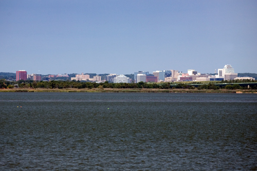
river, you can see the remnants of a pier from the amusement park and the ferry to New Castle that the twin bridges replaced. The photo above is the Wilmington
Skyline (which, interestingly, is situated on a riverfront -- the Christina River -- which on its way to the Delaware widens and serves host to the Port of
Wilmington).
* * *
On the far southern end of Pennsville is a neighborhood that apparently was never developed. Compare the map with the satellite view at Google Maps HERE. It's a little like Centralia, only the roads weren't ever built. Just south of this is an even weirder part of New Jersey: part of it that
is not even New Jersey.
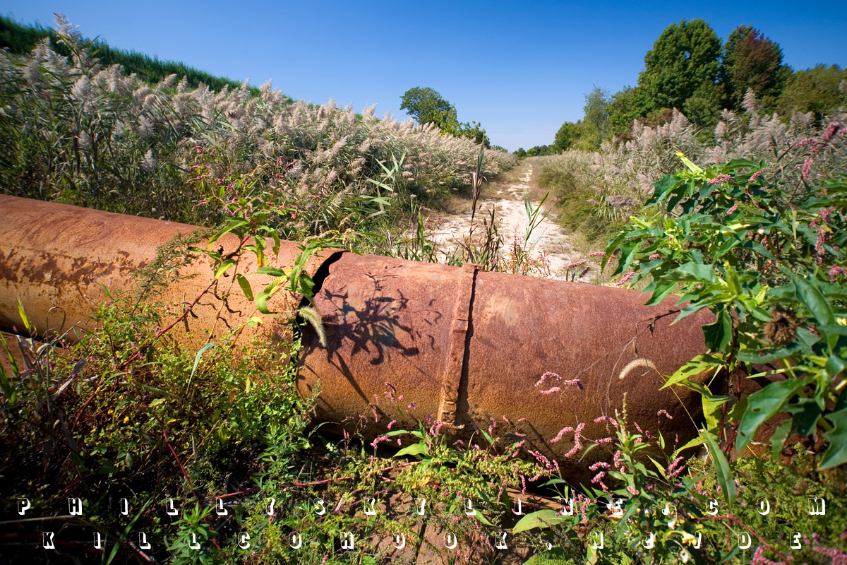
The Kilcohook Coordination Area is a not-quite-off-limits but not-exactly-advertised, 600 acre portion of the state of Delaware on the east side of the
river. The Army Corps of Engineers built the ground up with dredge spoils on land deeded to William Penn from the Duke of York in 1682. Exactly why it belongs to
Delaware is complicated. The rounded northern border of that state extends from the '12 mile circle' centered at New Castle County Courthouse. That 12 mile circle
also included a good bit of land across the river, but for practical reasons was never really accepted as Delaware. It took a dispute between the two states for the
US Supreme Court to rule in 1934 that Delaware is entitled to land on the Jersey side -- "all the land up to the low-tide line on the river's eastern shore."
(Press of Atlantic City via Cumberland
County Talk.) Matt O'Donnell did a feature story for 6ABC on this in January 2007, archived online HERE.
The photo above is at the north side of Killcohook, where Lehigh Road dead ends at this barrier. The barrier, placed there by the Corps, presumably prevents use and
abuse from vehicular traffic. Still, one can hike or, for example, ride a dirt bike back the several unpaved roads, all the way to the southern end, where
Killcohook meets up with the post-Civil War Fort Mott.
* * *
Fort Mott is one of the Three Forts of the Delaware. (Fort Mifflin and Fort Mercer, in Philadelphia and National Park, make five, and there are former Swedish and
Dutch forts along the Bay which no longer exist.) Along with Fort Delaware in the middle of the river and Fort DuPont in Delaware City, Fort Mott is served by a
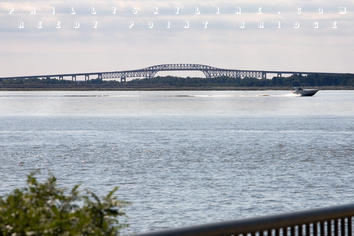
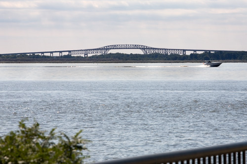
passenger ferry. The riverfront at Fort Mott (now a state park) has a promenade looking back toward the fort, south to the Salem nuclear station, and across the
river to the Reedy Point Bridge, seen above. Built in 1968, the two lane cantilever bridge spans the Chesapeake & Delaware Canal, which opened in 1829 and shaved
off a good 300 miles in the maritime trip from Philadelphia to Baltimore. The bridge was included in funding authorized by Congress in 1954 to widen and deepen the
C&D.
* * *
Let's fast forward a bit now, past Hancock's Bridge (site of a horrible overnight massacre by the British in 1778), past Hope Creek -- the official marking of the
Delaware River's shift to Delaware Bay on the Jersey side -- past Cohansey, Nantuxent and Maurice Rivers, past the small rural bayside towns to a more familiar
shore, as in down the. Cape May, the stuffy victorian resort town at New Jersey's southern point, has been popular with beach goers since long before the
railroad, and later the Garden State Parkway, brought out-of-staters here. But for the signs to the ferry, little attention is given to the Delaware Bay side of
the cape, and that's just how its residents like it. With a sunset over water to rival its sunrise over the Atlantic, the bayside beach is pin-drop quiet compared
to the ocean beach a couple miles away.
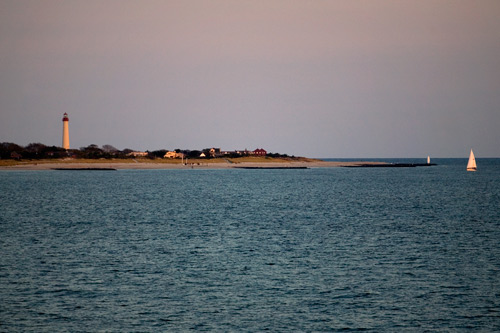
At the beginning of this post is the Cape May Lighthouse, which sits at the tip of the cape, where the Delaware Bay reaches its goal, the Atlantic Ocean.
* * *

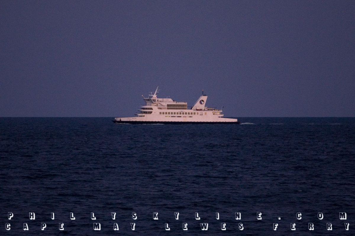
This here is a northbound Cape May-Lewes Ferry, seen from a southbound one. This photo (ISO 1000, f4.0, 1/125) was taken around 7 Saturday night, about
twenty minutes after the sun had set over Delaware Bay. The ferry began operation in 1964, providing a link between Jersey shore towns and Delaware/Maryland shore
towns. Ocean City and Ocean City were never closer before the ferry. US Route 9 (known in North Jersey as the 1 & 9, as it shares a prominent section with US-1)
officially crosses Delaware Bay on the Ferry's fleet. Each ferry holds up to 100 cars and 1,000 passengers.
The 17 mile journey takes 75 minutes and costs $34 for cars ($41 during peak summer months), $29 for motorcycles, and $9.50 for pedestrians. If I might offer a
recommendation, I'd suggest the southbound ferry at sunset and a room in Rehoboth Beach, less than ten miles from the ferry terminal in Lewes, Delaware.
* * *
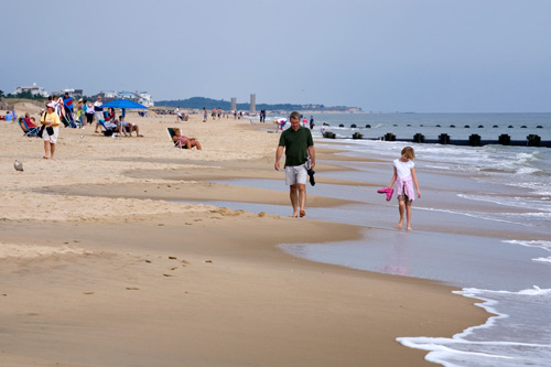
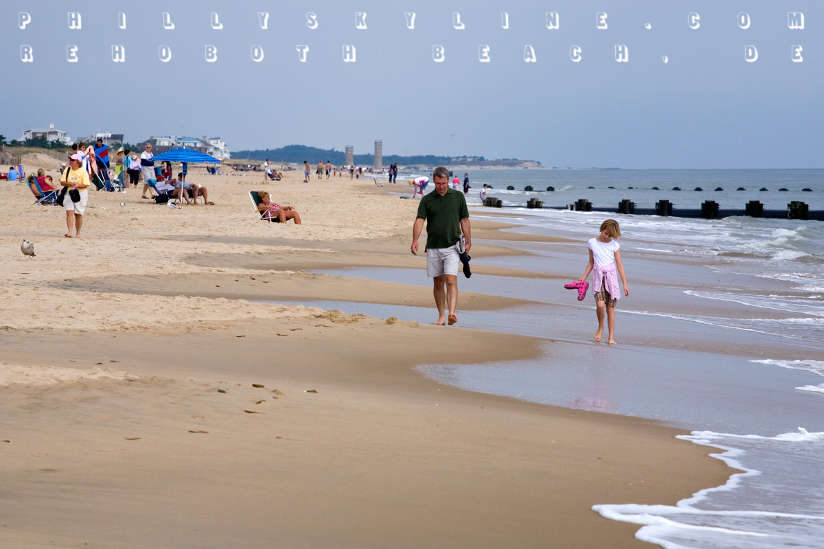
Rehoboth, it must be said, is a killer little beach town. While it has all the tchotchkes and garishness any shore town has, it's a little more openly gay friendly
than most, and oh yeah, it has the Dogfish Head Brewery. Rehoboth is the first resort town south of Cape Henlopen, Delaware state's farewell to the Delaware
River/Bay. You can see the Cape in the distance in the photo above. Rehoboth acknowledges its Delmarva existence with streets named for the Delaware, Atlantic and
Chesapeake each. (Philadelphia Street is two blocks south of Wilmington Street, which is two blocks south of Baltimore Avenue.)
* * *
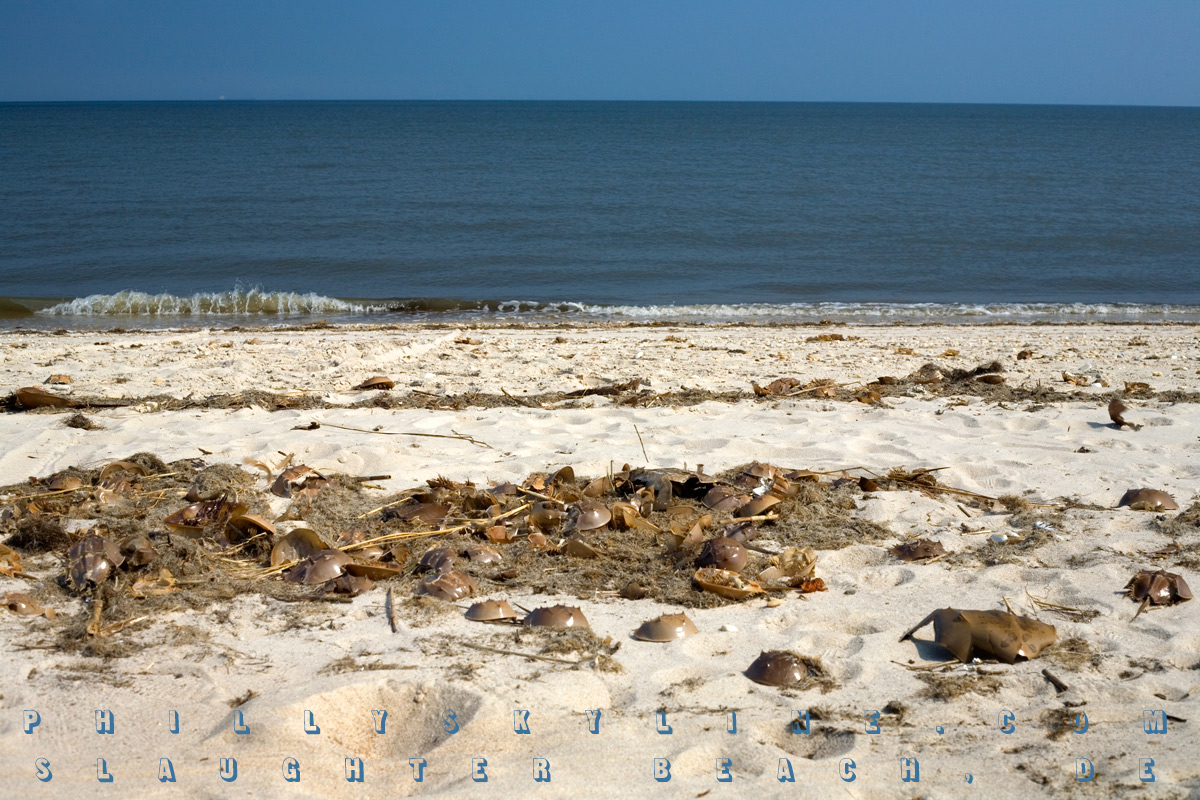
Heading north on Delaware's main line, State Route 1, the scenery turns quickly from outlets to farmland, with some marshland off to the right. That includes Prime
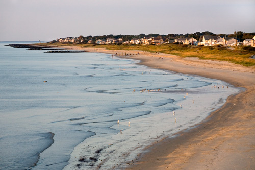
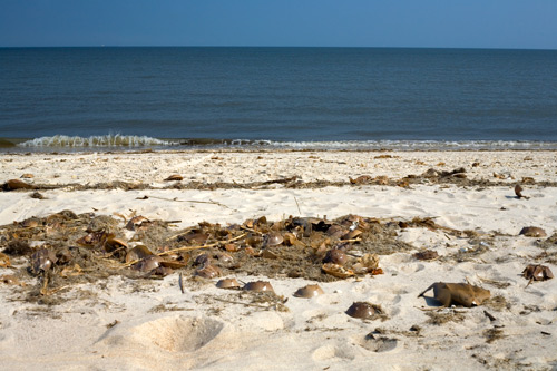
Hook and Bombay Hook Wildlife Refuges, home to tons of migratory shorebirds -- and mosquitoes and ticks. In between these is the small community of Slaughter Beach,
pictured above.
The 2000 US Census says Slaughter has a population of 198, but seeing it in person, I'd guess it's probably closer to 19. What look like vacation homes line
the shore of Delaware Bay, with only two small public parking areas. Once you're on the shore, though . . . wow. The tang is not of bay nor ocean air, but of dead
horseshoe crabs, which are everywhere. Rumor has it that's how the town got its name -- from the thousands of horseshoe crab carcasses after coming ashore to spawn.
Their scent is not overpowering, though, and the beach is calm and beautiful. Slaughter Beach is near the widest part of the Bay, i.e. furthest from Jersey, so you
can't even see the other side. You can, though, see the giant ships in the channel on their way to and from Philly, Camden, Wilmington and other points north on the
river.
* * *
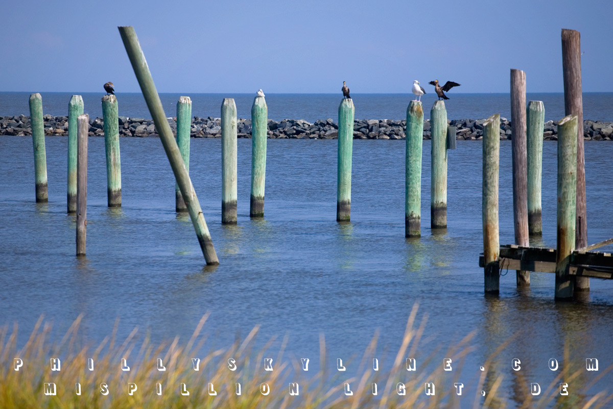
Just north of Slaughter, at the mouth of the Mispillion River, is the new DuPont Nature Center. The Mispillion Lighthouse occupied this site from 1873 to 2002, when
it was mostly destroyed by lightning. A Lewes-based enterprise purchased and moved what was left of it to build a replica at Shipcarpenter Square in Lewes. As part
of its Delaware Estuary Initiative, the DuPont Corporation contributed $500K of the Center's $2M
construction by the state of Delaware. The Center includes exhibits on birds, horseshoe crabs (which includes a tank of juvenile crabs) and bay views like the one
above.
* * *
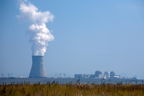
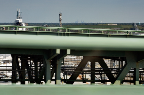
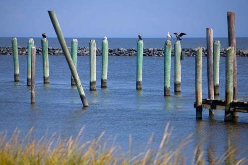
Back up north, past Liston Front Range Lighthouse -- which marks the Delaware side of the River/Bay change -- we'll make a stop in Port Penn, the tiny Delaware town
across the River from the facility pictured above. Generally called the Salem Nuclear Station, it's technically two facilities: the Hope Creek Nuclear Generating
Station (including the cooling tower that can be seen from Center City on a clear day) and the Salem Nuclear Power Plant, the round reactors just behind the double
masted ship. Together, they make up the second largest nuclear facility in the country. Both facilities are owned and operated by PSEG Nuclear. The Salem station's
web site is HERE.
* * *
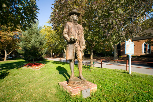
With a stop off in New Castle, it's evident we're getting close to home. Old New Castle is one of the better efforts of colonial preservation in the Delaware
Valley. The town dates to 1651, when the former Lenape village was settled by Peter Stuyvesant and the Dutch. After the Swedes wrestled it from them a few years
later and the Dutch wrestled it back a year after that, the British took the helm in 1664 and changed New Amstel to New Castle. It was under British rule when
William Penn arrived in 1682. The statue above stands behind the old county courthouse (old because the New Castle County seat is now in Wilmington) on the Green --
which was laid out by Stuyvesant and the Dutch.
* * *
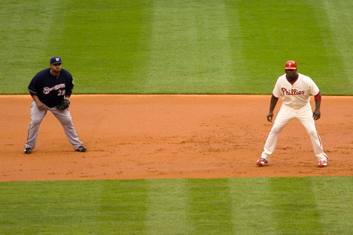
Finally, at long last, at the end of our Delaware River-Bay journey, we leave Stuyvesant's town green (as fine a place to watch the Phillies' deciding NLDS victory
over the Brewers as any -- get the pizza at Portofino) for Penn's green country town. About 33 miles upstream from New Castle is the town Penn ultimately gave his
direction, a town 90 miles from the Atlantic Ocean called Philadelphia. This sunset over the Philly Skyline looks maybe a little different than Billy Penn would
have seen it.
* * *
But sunset over the Delaware Bay -- the very reason for this exhausting trip? Looks as great now as it did in the head Quaker's day.

Some other photo essays from Philly's Delaware are coming this week.
–B Love
|
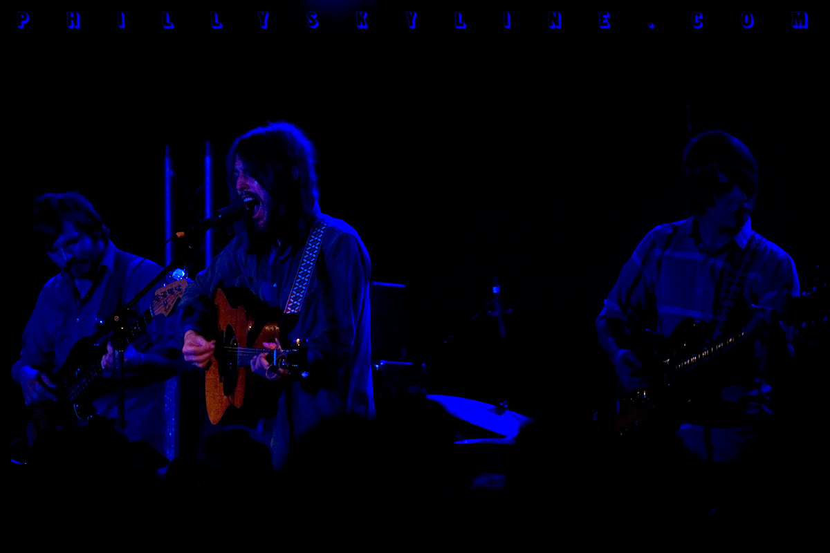
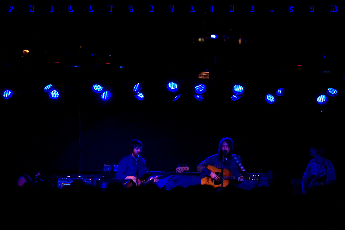
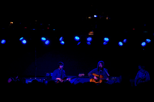
3 October 08: Blue Men Group
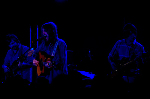
And then, after that victorious Victorino victory, we went to Starlight Ballroom, where Fleet Foxes did us the courtesy of waiting till we got off the subway to
start their set.
Tell you what, My Morning Jacket fans, this is one fine young band coming from Seattle. Having missed them at Johnny Brenda's in March and again at the First
Unitarian Church in June, I appreciated their courtesy of a third Philly show in 2008.
Their self titled album (which came out in June) definitely does have an
immediate MMJ taste, but the more listens you give it, the more Fleet Foxes' sound distances itself from MMJ's. While they use the same big-room reverb, the dude
(Robin Pecknold is his name) can't help it his voice sounds so near to Jim James'. (Nor that he looks so much like Dave Grohl.) Pecknold is a great singer, and
what he does with his voice is really the star of the album. And the multi-part harmony is the perfect complement.
It all transfers very well live. The band ran through the best of their short catalog, including the haunting "Your Protector", "Mykonos" from last year's EP,
and an encore closing "Blue Ridge Mountains", a nice nod to we of Appalachian upbringing.
It'll be interesting to see how this band of 20-somethings grows musically, to see where they'll go from this weird, dark folk thing they have now. Go 'head,
Fleet Foxes.
–B Love
|
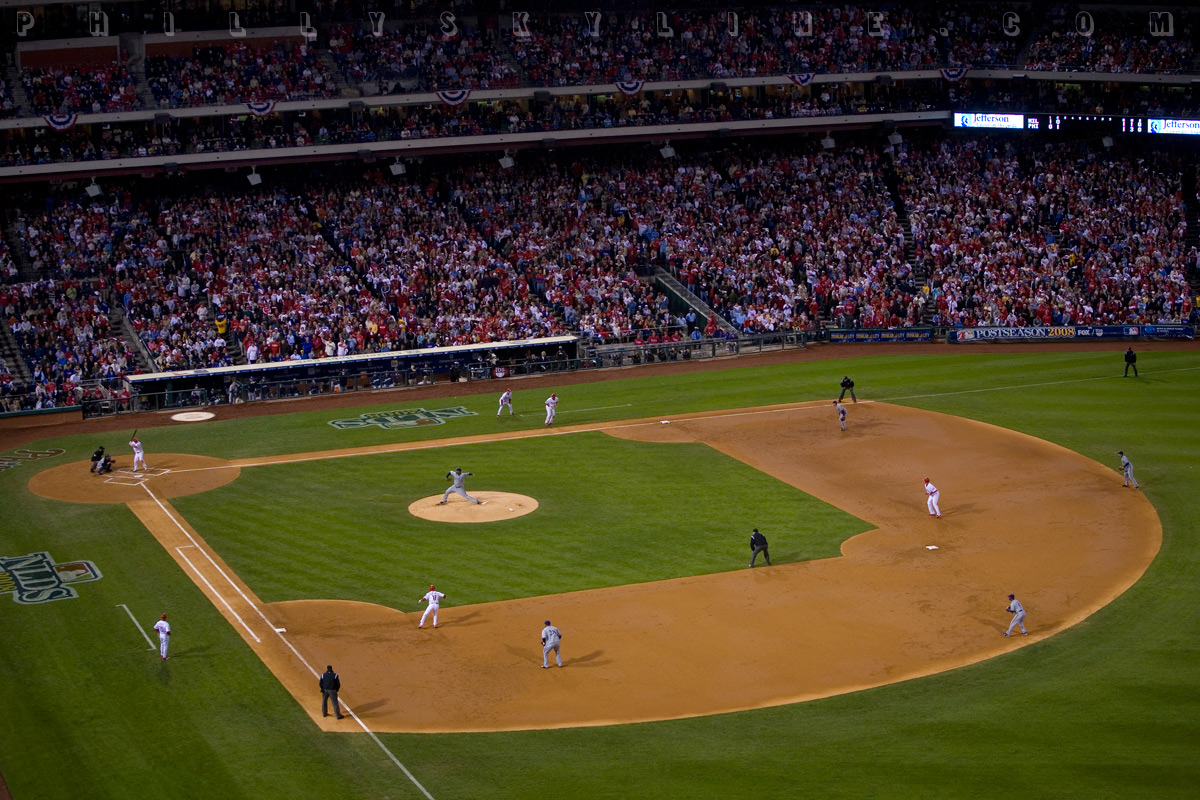
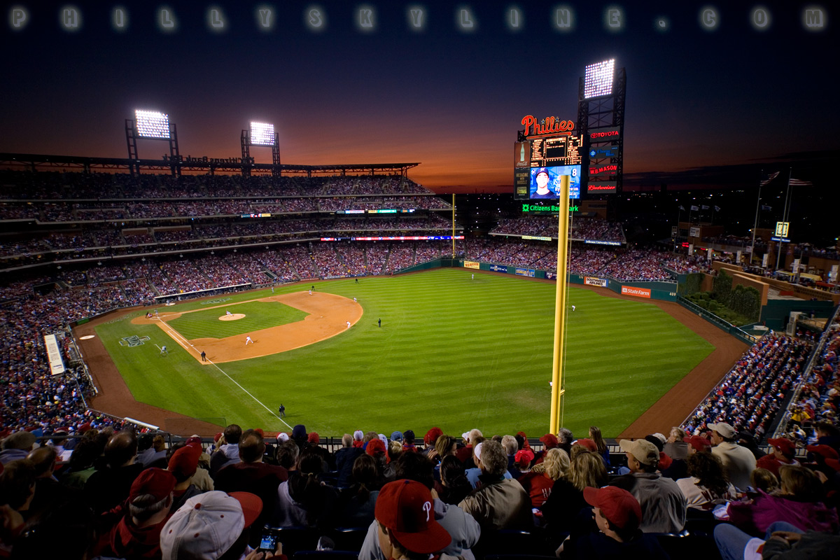
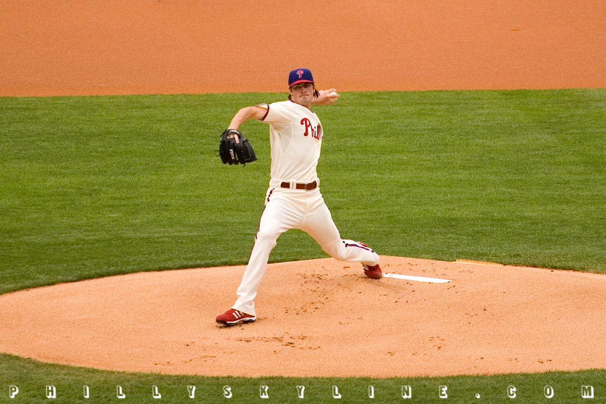
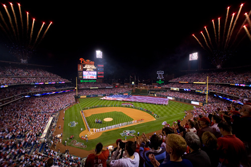
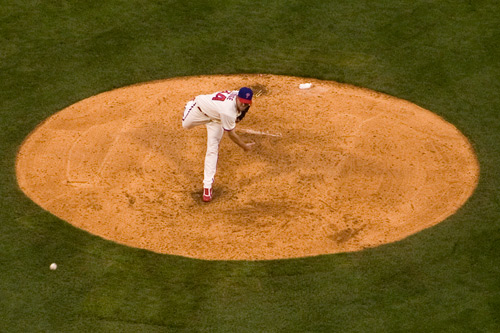
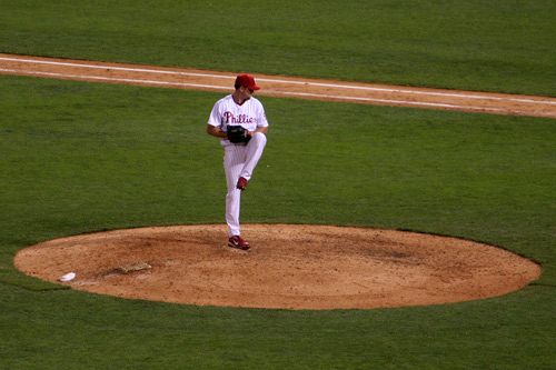
3 October 08: The Phillies Skyline Playoff Picture Show
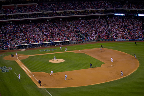
AND WE ALL KNOW WHAT HAPPENED NEXT.
I'd ask what the name of the train that ran me over last night was, but I already know it was the Hawaiian Express. (Heh heh, a train to Hawaii.)
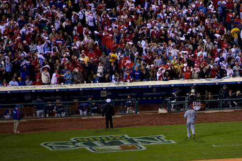
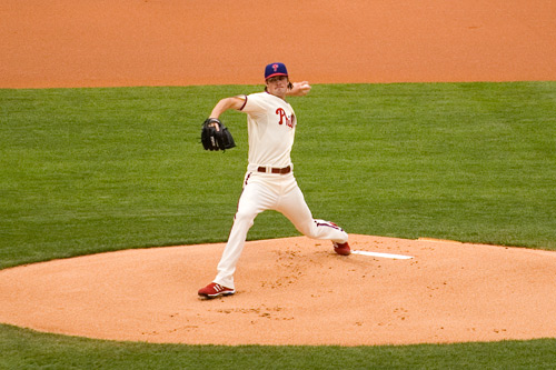
Lawda mussy, what a night. If playoff baseball is intoxicating when you win, it's annihilating when you beat one of the best pitchers in the game by simply
getting in his head. "CC SUCKS" might have been a little on the mean side (we all know he doesn't suck), but with that reverberating through a crowd of 46,000
and Brett Myers working a two-out, 0-2 count into a nine pitch walk? Holy moly. I don't think Shane Victorino's grand slam registered with me, or any of
the friends I went to the game with, until he was close to second base. That shot was stunning.
And Good Brett rose to the occasion -- it took him going against, and beating, CC Sabathia to bring him alive. Hallelujah!
In celebration of our boys heading to the midwest with a 2-0 lead, here are some wallpapers for the weekend -- mix em up, match em up, have a good time!


–B Love
|
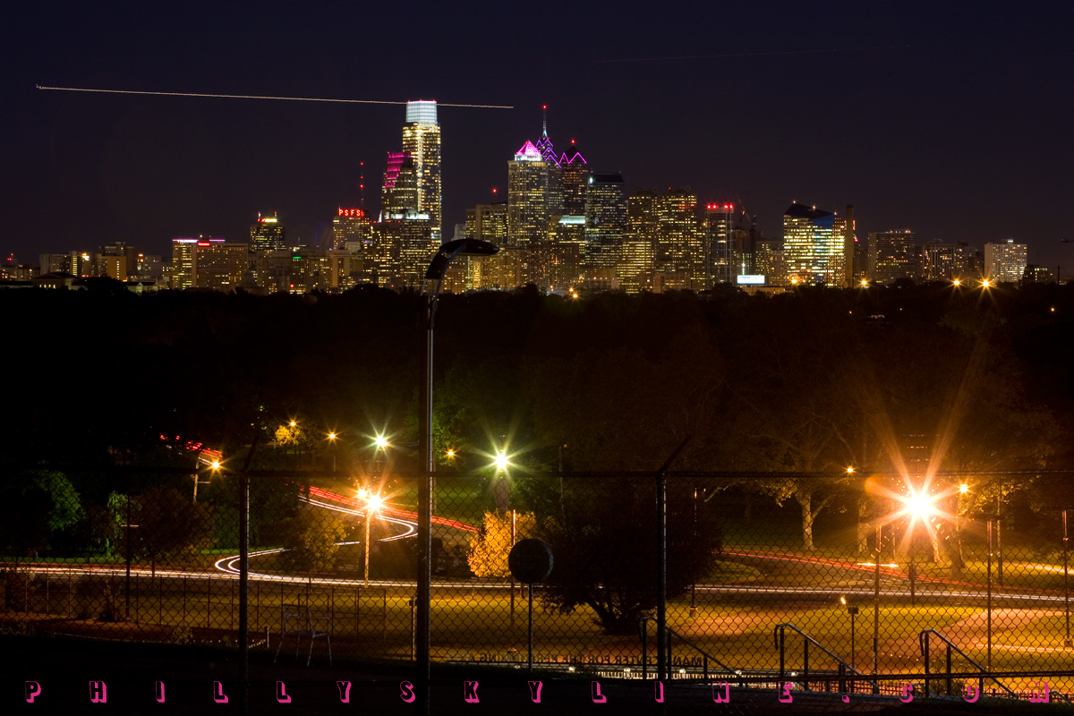
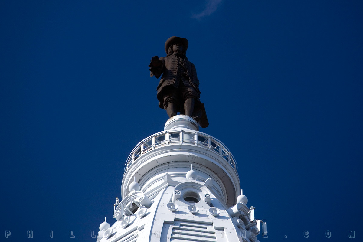
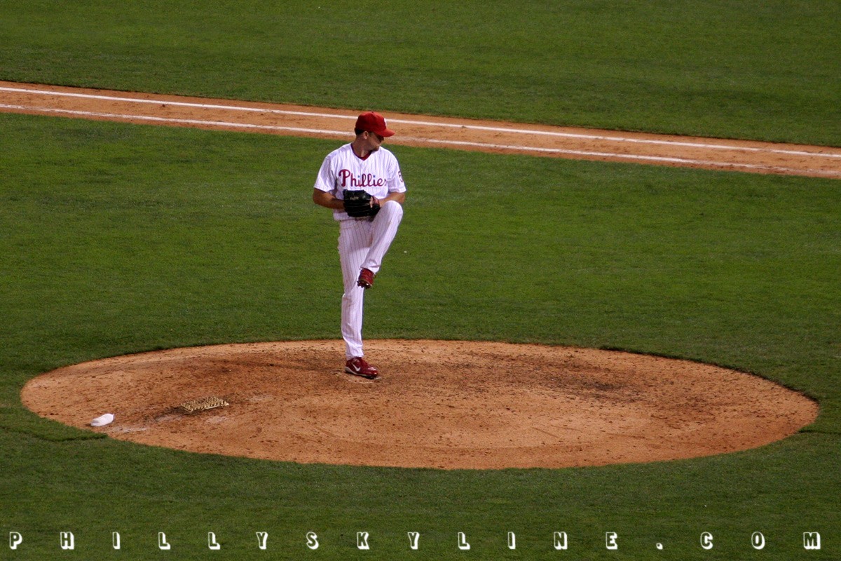
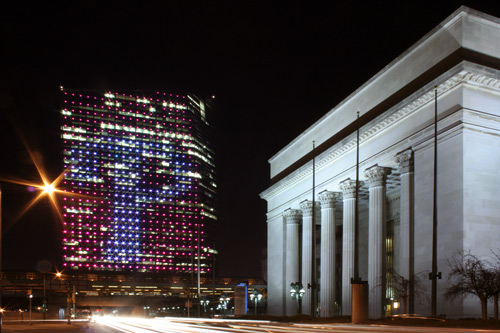
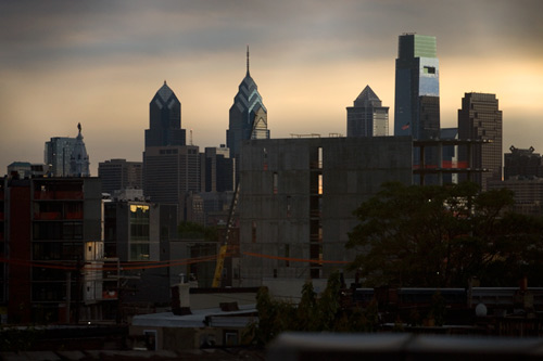
2 October 08: Today at City Hall
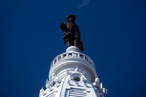
October in Philadelphia means two things: Phillies playoff baseball and William Penn attention. Those of you who purchased this year's Philly Skyline calendar
are this month treated to an up close and personal facial for the next 30 days -- enjoy! It was on this notion that I paid the 37 foot Quaker a visit this
morning on this most fantastic of clear fall days. That's him above, and below are seven of the views he takes in every day.
The third annual William Penn's Welcome Week kicks off next weekend and runs from the 11th to the 19th. (Penn's birthday is the 14th.) Why not take the
opportunity to visit a Penn place, like City Hall's observation deck or Penn Treaty Park or Pennsbury Manor? Or, choose from the special events for Welcome Week,
at USHistory.org HERE.
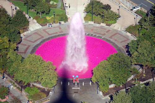
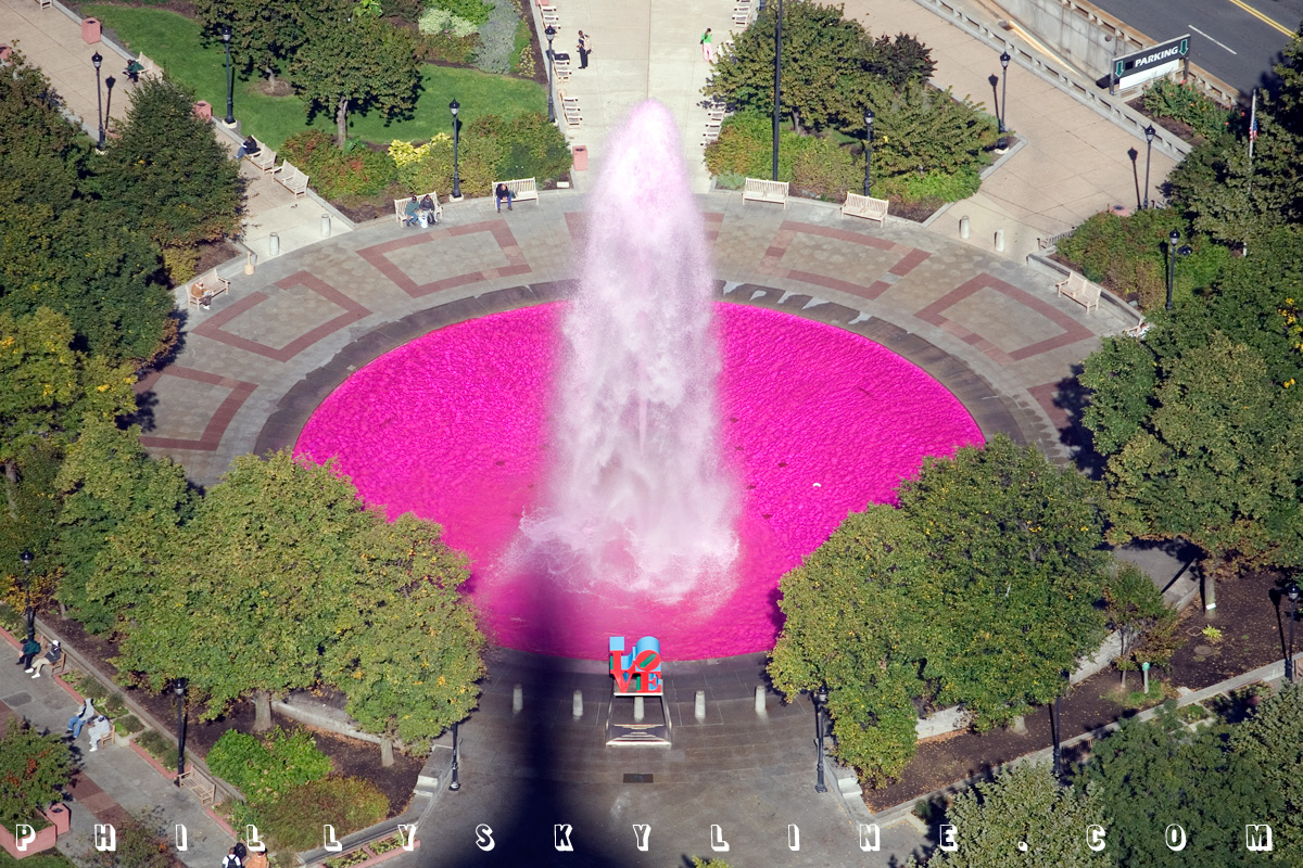
Love Park, pink for Breast Cancer Awareness Month.
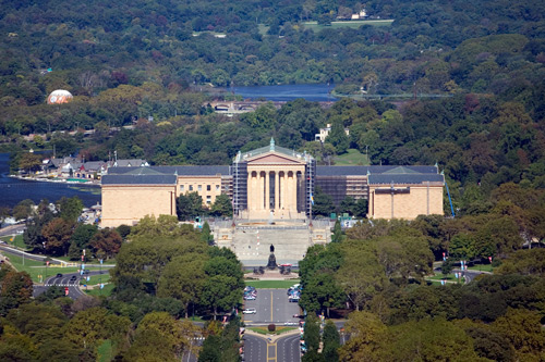
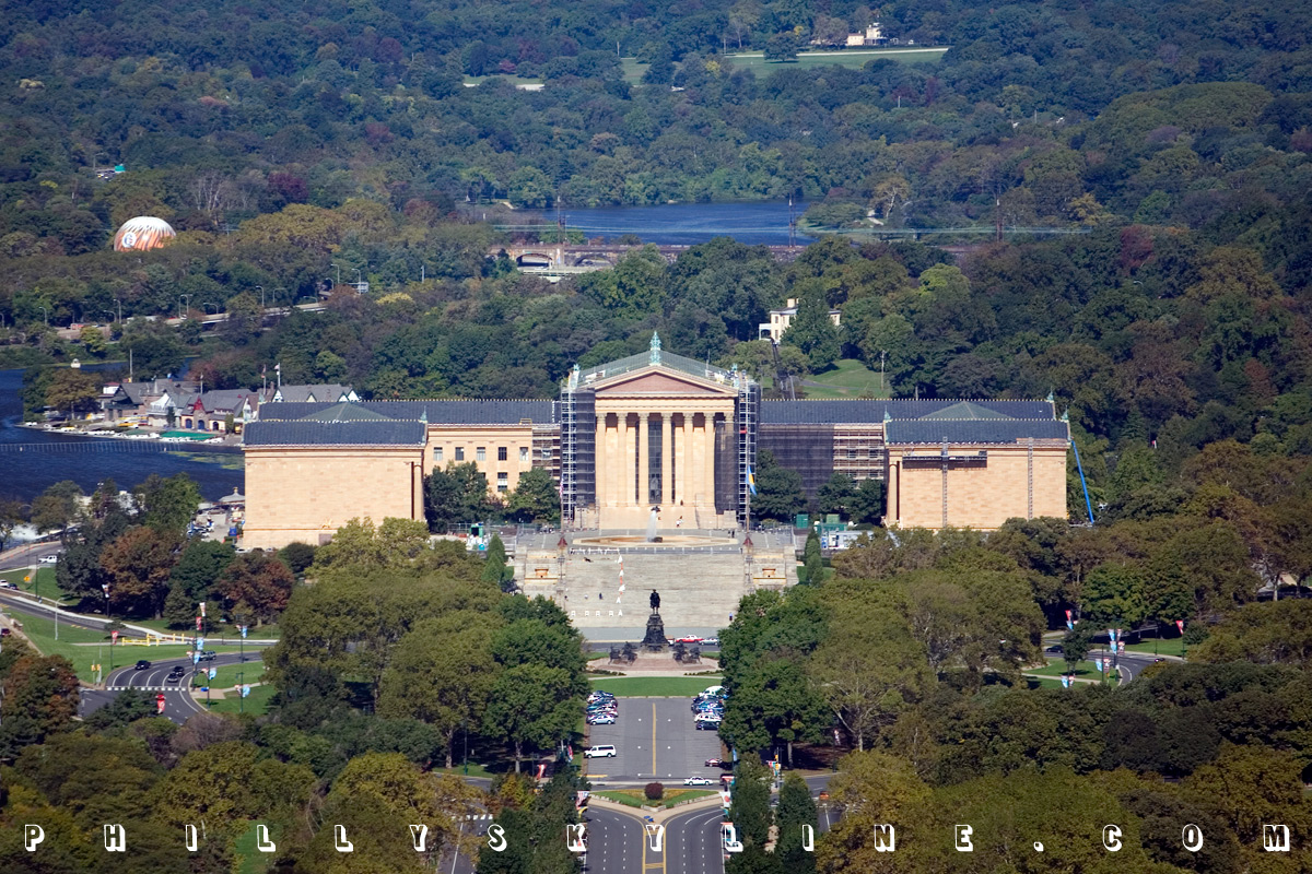
Philadelphia Museum of Art, Schuylkill River, Fairmount Park.
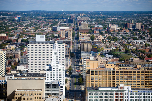
North Broad Street, Temple University.
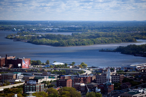
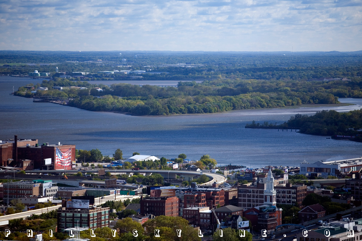
Petty's Island, Delaware River.
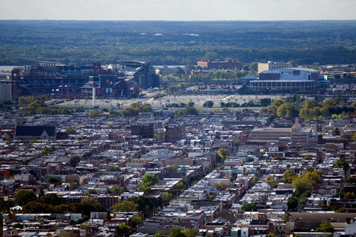
Sports Complex, South Philly.
Residences at the Ritz-Carlton.
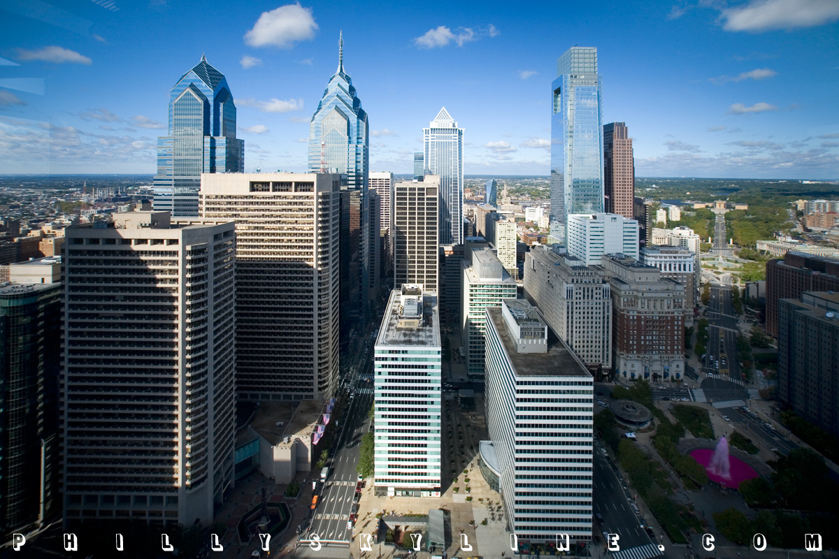
Philly Skyline.
Finally today, a big welcome to the American Society of Landscape Architects, who this evening kick off their annual expo in this year's host city Philadelphia,
Pennsylvania. How 'bout that. Events at the Convention Center begin this evening and run through Tuesday. For the schedule, visit the expo section at ASLA.org HERE.
–B Love
|
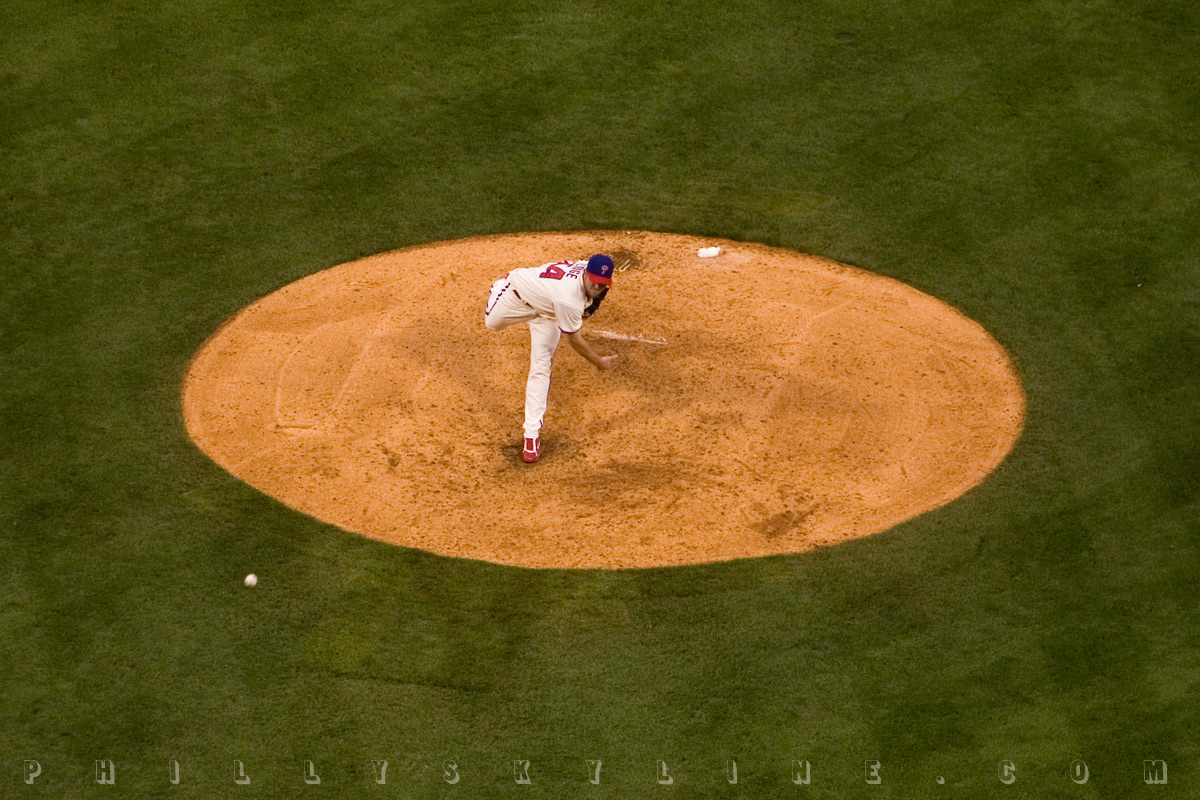
1 October 08: FALL BALL
Major League Baseball's second season begins right here in Phila-del-phi-a this afternoon at 3. Cole vs a rookie today, Myers vs Sabathia tomorrow, Phils vs
Brewers all week. To get in the spirit (and mail in this morning's post as I get ready to head down to the ballpark for some playoff baseball), here are some
Phillies Skylines to start off the new month.
LET'S GO PHILS!
–B Love
|
30 September 08: Methodological madness, or,
OKAY, PHILADELPHIA'S POPULATION
MAY NOT BE INCREASING . . . YET
Numbers, numbers, numbers.
When the US Census released its American Community Survey (ACS) last week, the news said that immigration was down. That Philly Skyline proponent of immigration
Nathaniel Popkin went to the source, combed the data, and made an incredible discovery no one
else had picked up on: Philadelphia's population is increasing, reversing a decades long decline.
Could that be? Could our giant rust belt city have finally put a plug of positivity into that drain, a Nutter icing on a cake we've been baking in Center City and
its growing extensions in the past 5-10 years? The numbers are right there, right on the Census' web site for the ACS. Click the number in question for the source.
The proof is in the pudding, yeah? The problem -- the conflict -- I've discovered in the days since this revelation (with a hand from a few readers) is from the
Census' official Population Estimates, which show Philadelphia as still on the slow decline.
Date | Philadelphia PA
| April 1, 2000 (US Census) | 1,517,550
| July 1, 2005 | 1,460,301
| July 1, 2006 | 1,453,212
| July 1, 2007 | 1,449,634
| April 1, 2010 (US Census) | ??? | | | | | |
Comparing the ACS and Population Estimate figures, 2005 is way off, 2006 is pretty close, and 2007 is exactly the same. To understand why, we have to know exactly
what ACS is.
The American Community Survey was developed by the Census in 1996, indirectly an answer to microtechnology, as a matter of improving Census data and its timeliness,
and for indicating local and national trends. The project was under testing and development through 2004 and finally rolled out in 2005 for counties over 65,000,
including Philadelphia. Questionnaires address things like age, income, language, disability and so forth. Administered by regional Census offices, the data is
collected via mail, telephone and computer.
 The 2005 ACS being the first implementation, one is willing to give the Census a pass, to allow a margin of error and find the kinks to iron out. Still, 40,000+ is
a pretty big discrepancy. Census statistician and ACS specialist Pamela Klein explains, "that first year, we didn't have the funding to calculate controlled
population," or those in group quarters: college dormitories, group homes and prison.
The 2005 ACS being the first implementation, one is willing to give the Census a pass, to allow a margin of error and find the kinks to iron out. Still, 40,000+ is
a pretty big discrepancy. Census statistician and ACS specialist Pamela Klein explains, "that first year, we didn't have the funding to calculate controlled
population," or those in group quarters: college dormitories, group homes and prison.
ACS' 2006 data was the first to include that controlled population, so the Philadelphia figures are pretty close, less than 5,000 difference. That's still a bit of
wiggle room when you consider 2007's figures match. Census mathematician Mark Asiala says, in so many words, that while the Census certainly strives for accuracy,
the ten year censuses are still the best, but that intercensal figures are getting better every year.
"The Population Estimates use the best files and most modern methodology available," he says. "They're also revised every year, [into] what we call 'vintage'
statistics." The vintage statistics are those you see in the Estimates, refined with additional data -- like that from ACS, which uses a different methodology --
compiled in the time between the estimates. When I asked him if that meant that the 2007 ACS and Estimate figures would no longer match when the 2008 figures come
out, he said yes. I can't begin to explain the methodologies, but each is online: ACS methodology & Population Estimate methodology.
Basically, what we can take from this is that the American Community Survey is best for studying trends, while the official Census is the best place for the hard
numbers for the pissing matches between places like Philadelphia and Phoenix.
Greg Heller, the DVRPC planner mentioned last week, has said, "I am tired of comparisons to
Phoenix. There is just no sense to it. When you look at city versus metropolitan numbers, the irrationality of comparing these places becomes abundantly clear."
| City of Philadelphia | City of Phoenix
| 142 sq mi* | 475 sq mi
| 1,456,350 projected population | 1,461,575 projected population
| * * * | * * *
| | Philadelphia MSA | Phoenix MSA
| 5,118 sq mi | 14,573 sq mi
| 5,823,233 population | 3,715,360 population | | | | | |
* - Figures are from DVRPC's GIS shape file data. Philadelphia's area includes waterways in the calculations, which is why it is 142 sq mi instead of the widely
accepted 135. As well, Phoenix's 475 sq mi is from the last official census, as opposed to the 517 quoted from Phoenix's municipal government web site last week.
Also worth noting here is that DVRPC has its own data analysis comparing the Census with the ACS, online HERE.
Heller elaborates, "citywide population numbers are totally useless, except in terms of the city's national image. What matters is whether there are a significant
number of neighborhoods gaining population, and in Philadelphia there are. . . . [But] it would be nice if we could shift the national perception that Philadelphia
is on the decline."
* * *
The improving ACS and the weight given it by the Census Bureau do underscore our Information Age. The monthly-collected, annually-released ACS and the traditional,
decennial Census will eventually merge. By the time they do, there will probably be blogs with countdowns pitting Philadelphia against San Antonio and columns in
each city's newspapers mocking the other. Hell if the Census wanted to get Google involved, the data could probably stream in real-time, never mind monthly or, how
antiquated, every ten years.
It's funny to consider that the Census' conduction every ten years is a matter of the original draft of the Constitution, that it does have bearing on
policy. From Article I, Section 2 of the
US Constitution, written somewhere near 5th & Chestnut:
Representatives and direct Taxes shall be apportioned among the several States which may be included within this Union, according to their respective Numbers, which
shall be determined by adding to the whole Number of free Persons, including those bound to Service for a Term of Years, and excluding Indians not taxed, three
fifths of all other Persons. The actual Enumeration shall be made within three Years after the first Meeting of the Congress of the United States, and within every
subsequent Term of ten Years, in such Manner as they shall by Law direct.
Count your white indentured servants fairly, never mind the untaxed savages, and pad your counts with an additional 3/5ths per negro, OK? What your count adds up to
will determine your Congressional Apportionment,
your number in the House of Representatives. In that 1787 writing, only Massachusetts had as many -- eight -- Reps as Pennsylvania. After the first Census in 1790,
PA had 13 Reps while Mass gained another, at 14. Pennsylvania peaked at 36 in the roaring twenties; now, we have 19.
It's possible that number could go down after the 2010 Census, too, as it has done every Census
since 1960. If it does, and if -- when -- Philadelphia's population is revealed at yet again a number less than the previous Census, the Congressional
redistricting may very well happen here.
The good news is that the 2010 population might not be as low as we'd have predicted in 2000. In fact, the 2006-2007 Estimates difference, a loss of 3,578, is the
smallest of all available figures this decade. We're almost there. In Rizzo's 70s, anyone who said Philadelphia would stop losing people and actually return to
adding people would have been crazy. By 2010, they might be right.
–B Love
|
|